RaritanLenape.org > Lenape People / Stories > Lenape History, Town by Town > Clinton & High Bridge
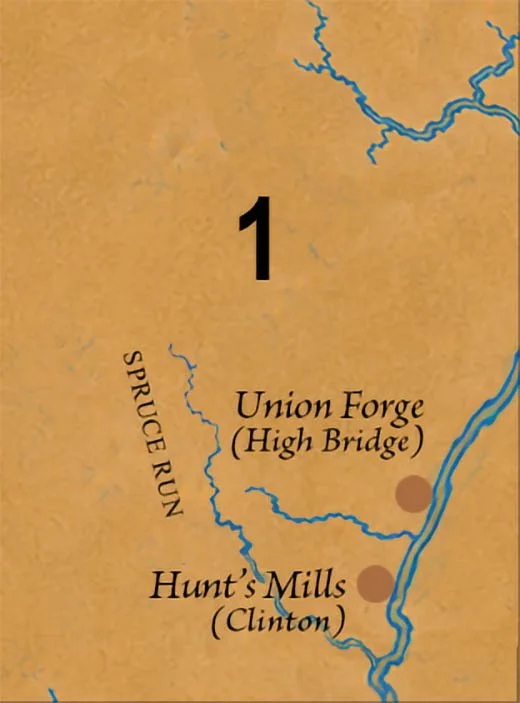
Clinton & High Bridge
Centered along the upper South Branch of the Raritan River, the Clinton & High Bridge region stretches across the wooded valleys, streams, and ridges of northwestern Hunterdon County.
Along the Upper South Branch
Before there was a Clinton, High Bridge, Annandale, or a road through the hills, there was the river. The South Branch of the Raritan wound between wooded ridges and through valleys rich with streams, game, fish, plants, and natural crossings. For thousands of years, Indigenous people moved through this landscape, leaving behind camps, workshops, stone tools, trails, and names that survived long after the Lenape themselves were displaced.
Today, much of that older world lies beneath towns, highways, farms, and even a reservoir. But enough remains to reveal something remarkable: the Clinton–High Bridge area was an especially active Indigenous landscape.
High Bridge: 44 Sites in Five Miles
High Bridge appears to have been particularly important. An early archaeological survey documented 44 Native sites in an area less than five miles long and two miles wide, extending south toward Clinton. Nineteen were along the South Branch of the Raritan, eleven along Spruce Run, and others beside smaller tributaries. Most were interpreted as temporary camps, but three contained enough flakes and unfinished stone objects to be identified as workshops where tools were being made.
The location helps explain the concentration. High Bridge sits where the South Branch passes the southern edge of Musconetcong Mountain, near natural routes through the highlands toward Glen Gardner and German Valley. Waterways, mountain gaps, and sheltered valleys made this a natural crossroads.
To someone traveling here centuries ago, the river and mountains were not scenery. They were the map.
Following an Ancient Route
One of the region's most fascinating survivals is the Lower Minisink Trail, a Lenape route connecting the Delaware and Raritan rivers. It crossed what is now Clinton Township, where artifacts found along the route have been associated with hunting, camping, travel, and trade.
European settlers eventually followed the same corridor. The Indigenous trail became associated with the Easton–Brunswick Road, connecting Easton with the Raritan Valley and New Brunswick. In 1806 it became part of a turnpike system, and later transportation routes continued to follow portions of the same geography.
There is even a Minisink Trail historical marker in Clinton, identifying a connection between the upper and lower trail systems used by Lenape travelers moving between the Delaware and Raritan.
The names and pavement changed. The corridor remained.
Spruce Run: A Landscape Beneath the Water
The peaceful water of Spruce Run Reservoir hides another part of the story.
Before the reservoir existed, this was a landscape of streams, woods, fields, and archaeological sites. Union Township reports that the majority of its known sites containing Native artifacts now lie beneath Spruce Run Reservoir. The same historical record describes an Indigenous trail following Mulhockaway Creek through Union Township toward High Bridge.
Imagine the reservoir disappearing for a moment. The water recedes, the old valley floor returns, and streams once again run through land where Indigenous people camped, hunted, traveled, and worked stone.
Beneath a twentieth-century reservoir lies a much older human landscape.
Mulhockaway Creek & Pattenburg
West of Clinton, Mulhockaway Creek formed another natural corridor through the region. Archaeologists documented several Native sites near Pattenburg. Finds included numerous argillite projectile points, along with implements made from flint and jasper and other stone tools. Argillite was an important material for Indigenous toolmaking and was transported throughout the wider region.
These objects make the history unusually personal. Someone selected the stone. Someone shaped it beside a stream. Someone carried it through this valley and, centuries later, it remained.
Mulhockaway itself is another survival of the Indigenous landscape: an old Native-derived name still attached to the creek today.
A Landscape That Still Remembers
Clinton, High Bridge, Glen Gardner, Hampton, Annandale, Jutland, and Pattenburg are comparatively recent names. The Lenape knew this country through its rivers, streams, ridges, crossings, hunting places, and trails.
Some traces remain obvious. Others lie underground or beneath the waters of Spruce Run.
And some survive every time we say names such as Raritan, Musconetcong, and Mulhockaway.
The towns came later. The landscape was already known.
Explore This Region
Clinton • High Bridge • Glen Gardner • Hampton • Annandale • Spruce Run • Jutland • Pattenburg • Union Township • Clinton Township • Bethlehem Township
explore the next town > 2/12