RaritanLenape.org > Lenape People / Stories > Lenape History, Town by Town > Bound Brook & Bridgewater
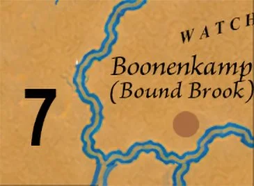
Bound Brook & Bridgewater
Bound Brook, South Bound Brook, Bridgewater and surrounding central Raritan River communities.

A BEND IN THE RIVER
Long before bridges crossed the Raritan, before roads climbed toward the Watchung Mountains, and before colonial surveyors began dividing the valley into parcels of land, this was a place of families, homes, and familiar pathways. Here, the Lenape lived among rivers and wooded ridges they had known for generations. And in one remarkable document from 1681, three Indigenous names survived the centuries, offering a rare glimpse of the people who called this valley home.
Today, the region is crossed by highways, railroads, and busy commercial streets. Yet beneath the modern landscape, its ancient geography remains. The Raritan River still curves around Bound Brook. Middle Brook descends from the Watchungs. The wooded ridges still overlook the valley where Indigenous families once fished, hunted, cultivated crops, and traveled between neighboring communities.
Bound Brook: Three Names from 1681
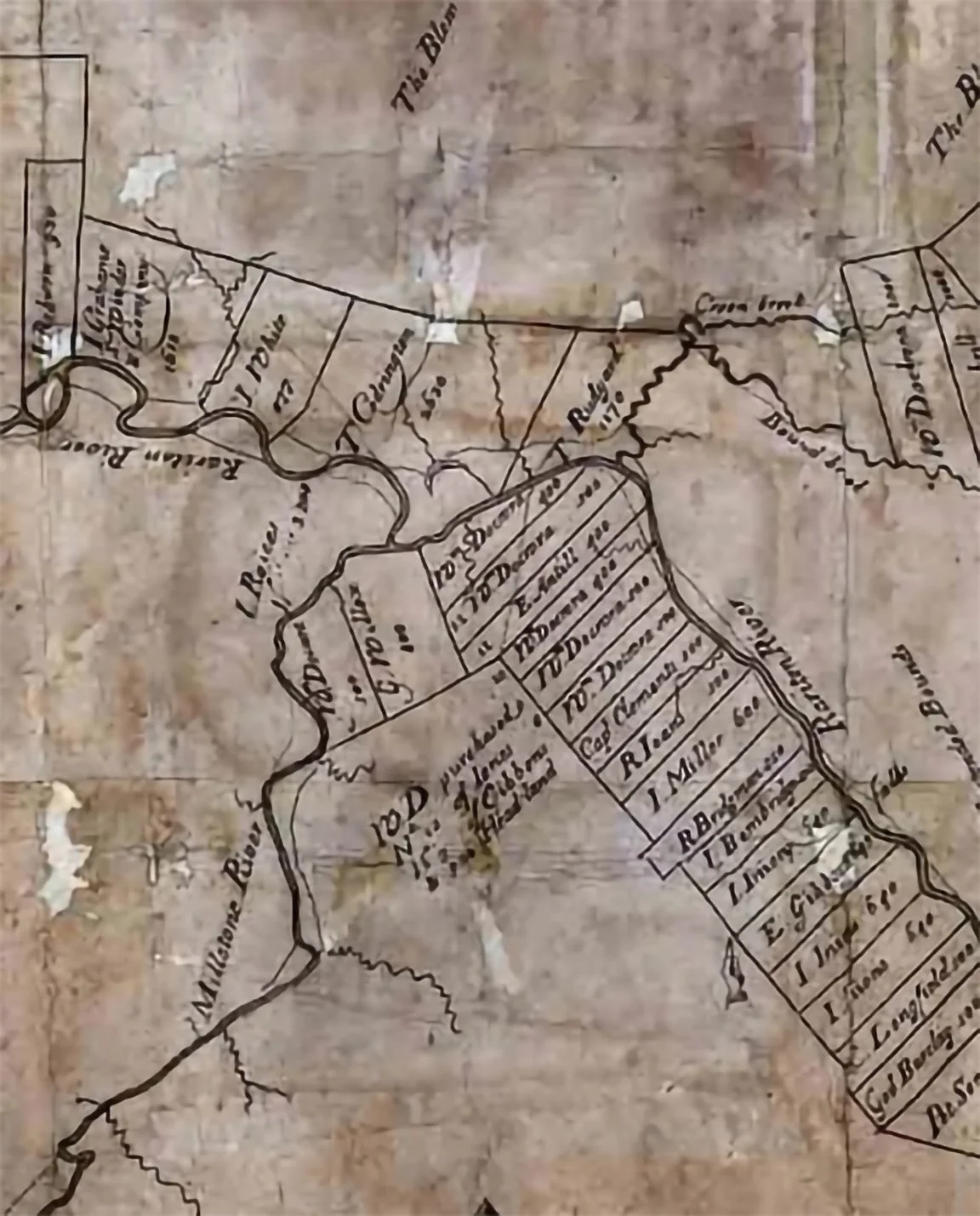
On May 4, 1681, two Raritan Indigenous men, Konackama and Queromak, were named in a deed conveying a large tract of land north of the Raritan River to European purchasers, including Governor Philip Carteret.
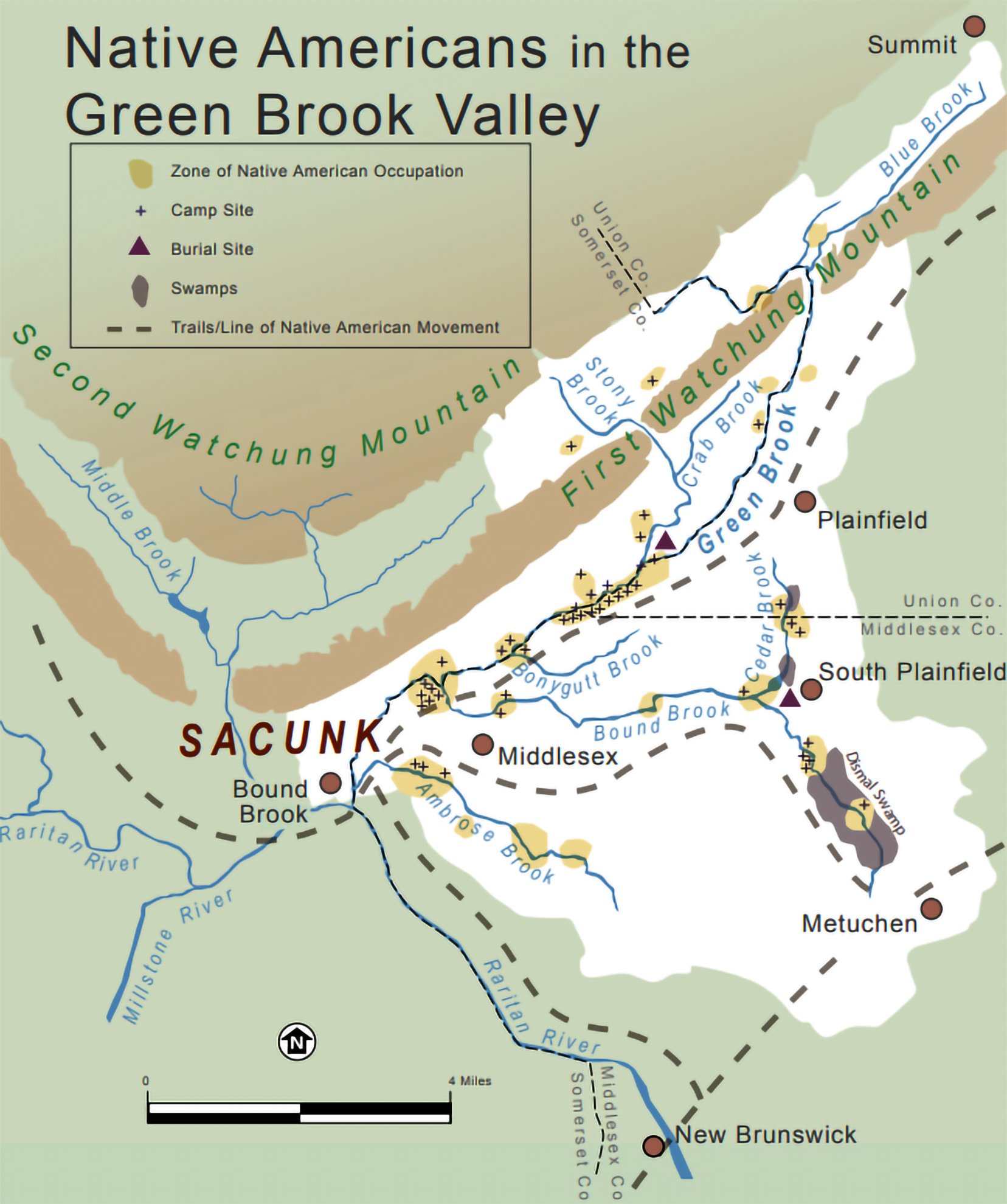
The deed described a landscape of rivers, wooded hills, and familiar landmarks. Among them was Sacunk, an Indigenous name associated with the stream later known as Bound Brook. Even more remarkably, the document identified the wigwam of a man named Metape as a boundary landmark.
It was a rare acknowledgment of something colonial land records so often obscured: this was already an inhabited landscape, with homes, families, and names long before European property lines appeared.
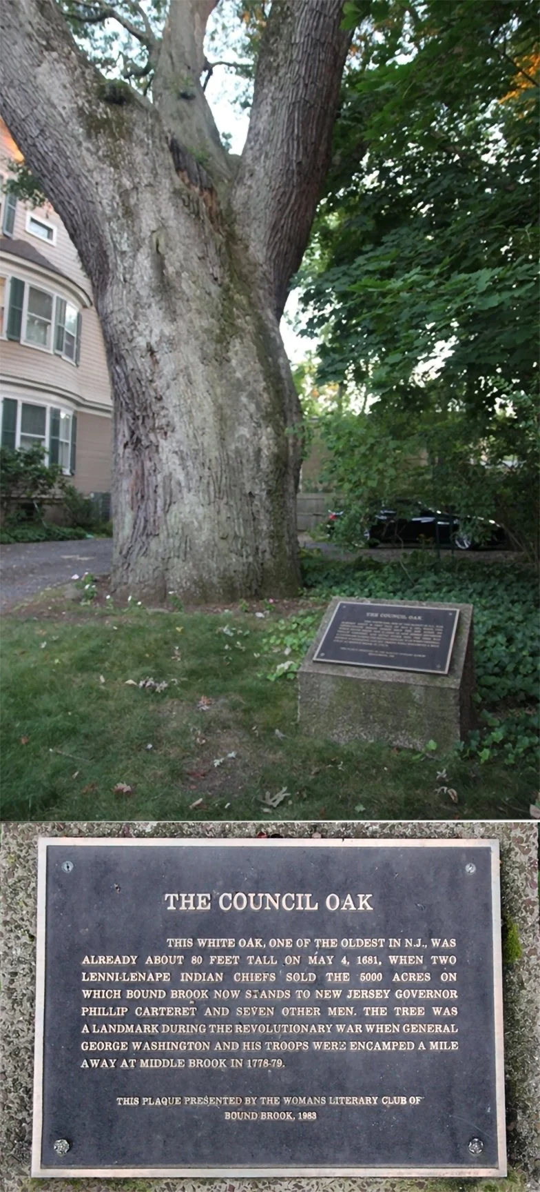
On East Maple Avenue in Bound Brook, an ancient tree known as the Council Oak became a local symbol of that early encounter. Tradition associates the oak with the 1681 land transaction, and a historical marker commemorates its connection to the area's Indigenous past. Although the precise events surrounding the tree cannot be independently established, its story has endured as part of Bound Brook's historical memory.
Three names survived in the written record. An old oak helped keep their story alive.
Bridgewater: Between River and Ridge
The landscape of present-day Bridgewater offered an extraordinary variety of natural resources.
The Raritan's fertile terraces supported cultivation. Its waters provided fish and transportation. Forests supplied deer, turkey, nuts, and useful plants, while smaller streams connected the lowlands with the Watchung Mountains.
Middle Brook formed a natural passage between the river and the northern hills. For Indigenous travelers, these waterways and valleys were part of a larger network connecting settlements, seasonal gathering places, and neighboring communities.
The Watchung ridges, later famous for their role in the American Revolution, had been familiar features of the Indigenous landscape for countless generations.
The 1681 deed captures this geography at a moment of profound change. The river, mountains, and streams were still recognizable Indigenous landmarks, but they were also becoming the boundaries of European landholdings.
By 1683, Thomas Codrington, one of the original purchasers, had established a property called Rackawackhana in the Middle Brook area.
The transformation of the valley was accelerating.
South Bound Brook: A River That Connected
Today, the Raritan separates Bound Brook from South Bound Brook. For the Lenape, however, the river was part of a connected landscape rather than a boundary.
Its banks offered fishing grounds, fertile soils, and access to neighboring territories. The river itself provided a natural corridor through central New Jersey.
Along the southern side of the Raritan, a route later known as the Road Up Raritan followed a corridor associated with earlier Lenape travel. During the colonial period, this route developed into a road connecting communities farther east with the Bound Brook area.
The precise paths changed as farms, bridges, and settlements appeared, but the underlying geography continued to guide movement.
Long before the roads had names, people already knew where they led.
When the Land Changed Hands
The 1681 deed was more than a transaction. It marked part of a larger transformation that would reshape the Raritan Valley.
Land known through generations of Indigenous occupation increasingly became property measured by surveyors, divided among purchasers, and recorded in colonial documents.
Farms spread across the river terraces. Mills appeared along the streams. Roads connected growing settlements. Over time, colonial expansion restricted Lenape access to ancestral lands and contributed to the displacement of Indigenous families.
Yet the surviving records tell only part of the story.
We know the names Konackama and Queromak because they appeared in a European deed. We know of Metape because his home marked a boundary.
We do not know what these men thought of the transaction, what conversations preceded it, or what became of their families. The voices of the women, children, and elders who shared this homeland are largely absent from the written record.
The documents tell us how Europeans acquired the land. They reveal far less about the people who lost it.
What Lay Beneath the Old Chestnut Tree?
Not every trace of the Lenape past survived in written documents. Some remained hidden beneath the earth for centuries.
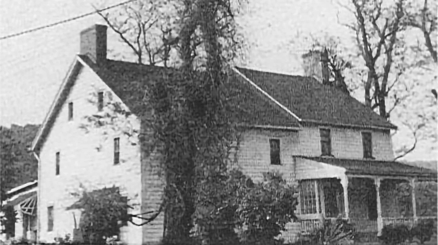
Near Green Brook Road, approximately 300 feet west of a historic house known as Twin Chimneys, once stood an enormous chestnut tree measuring 27 feet in circumference. It was not Bound Brook's celebrated Council Oak, associated by local tradition with the 1681 land transaction, but another ancient tree with a remarkable story of its own.
Around 1925, when the towering chestnut was removed, workers reportedly uncovered numerous Indigenous objects beneath its roots. Among them was a stone axe later possessed by a local resident named C. Vail. In May 1940, Vail, then more than 90 years old, recounted the discovery and reportedly provided a photograph of the tree.
What had been hidden beneath those roots, and why?
The historical account, preserved by the Green Brook Historical Society, offered an intriguing possibility: the objects might have marked the burial place of an important Indigenous leader. Their unusually well-preserved condition led the writer to speculate that they were burial offerings, perhaps placed with a chief. But no documented archaeological investigation has confirmed a burial, and the objects' original purpose remains unknown.
Elsewhere in the Green Brook valley, pottery fragments, projectile points, and stone implements were reported near Sebring's Mill, a property associated with Metape's dwelling, identified as a landmark in the 1681 deed.
Together, these discoveries reveal a history far older than the colonial records that first named the people of this valley. The deeds documented land changing hands. The objects beneath the soil offer glimpses of generations who lived here long before those transactions, and whose stories were rarely recorded in writing.
What the Valley Remembers
Nearly three and a half centuries later, the landscape has changed beyond anything its seventeenth-century inhabitants could have imagined.
Bridges span the Raritan. Highways cross the old river terraces. Homes and businesses occupy land once described through streams, mountains, and Indigenous dwellings.
Yet the river still follows its ancient course. Middle Brook still descends from the Watchungs. And the names of three men remain in a document dated May 4, 1681.
Konackama. Queromak. Metape.
They are more than names in an old deed. They are reminders that this valley had a human history long before Bound Brook, Bridgewater, or South Bound Brook appeared on a map.
The towns came later. The river was already home.