RaritanLenape.org > Lenape People / Stories > Lenape History, Town by Town > Somerville, Hillsborough & Millstone
Somerville, Hillsborough & Millstone
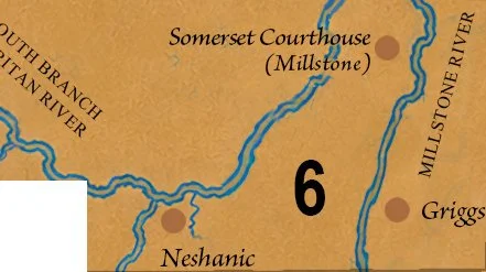
Somerville, Raritan, Manville, Hillsborough, Millstone, East Millstone, Neshanic, Neshanic Station, Griggstown, Flagtown, Blackwells Mills, and Belle Mead.

WHERE THE RIVERS REMEMBER
Some of the most extraordinary chapters of New Jersey's Indigenous history are hidden in places thousands of people pass every day. Beneath the streets of Somerville, across the farmland of Hillsborough, and beside the quiet waters of Millstone lies evidence of a world that existed long before these communities had names.
Here, ancient stone tools, forgotten village sites, and early colonial accounts reveal a landscape that was not wilderness awaiting settlement, but a homeland already known, cultivated, and inhabited for thousands of years.
What makes this part of the Raritan Valley especially remarkable is how much of that earlier world can still be traced. The rivers continue to follow their ancient courses. The fertile terraces remain. And in Millstone, a large stone mortar once used by Indigenous inhabitants survives as a tangible reminder of the people who lived here before European colonization.
Hillsborough: Twelve Thousand Years Beneath the Fields
A farmer turning the soil in Hillsborough might uncover something far older than the farm itself: a carefully shaped stone point, made by human hands thousands of years before the first colonial settlement.
This is more than a possibility. Hillsborough's official Natural Resource Inventory reports the discovery of Clovis-type spear points, evidence of human activity in the township approximately 10,000 to 12,000 years ago, when mastodons and mammoths still inhabited New Jersey. Archaeological finds from successive prehistoric periods suggest an exceptionally long history of Indigenous occupation.
These earliest inhabitants preceded the historically documented Lenape by many millennia. Yet their presence establishes something profound about this landscape: the story of Hillsborough did not begin with its farms, roads, or eighteenth-century villages. It began in the deep human past.
As generations passed, Indigenous people continued to use the Raritan Valley's rivers, forests, and fertile lowlands. By the time Europeans arrived, this was part of the Lenape homeland, where communities understood the seasonal rhythms of the land and drew upon its resources for food, shelter, and daily life.
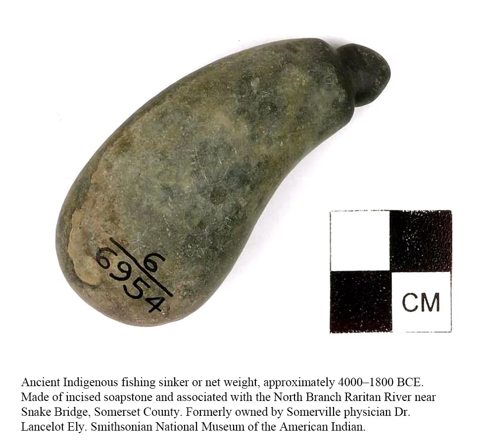
The archaeological record preserves only fragments of those lives. A broken stone point, a scraper, or the remains of a hearth may appear ordinary, but each represents a moment of human activity that would otherwise have disappeared from history.
Somerville: A Landscape Before the Streets
Stand near the Raritan River in Somerville and imagine the town without its courthouse, commercial streets, or neighborhoods. Remove the bridges and railroads. Imagine wooded banks, open river terraces, and paths shaped by generations of travel.
The river would still be there.
The land occupied by modern Somerville formed part of the wider Raritan landscape inhabited by Indigenous people long before the borough emerged. Its position near the meeting of the Raritan's North and South branches made the surrounding valley a natural place for movement and access to water, fish, fertile soils, and neighboring territories.
For Lenape families, rivers were not barriers dividing towns. They were connections between places. Their banks offered opportunities for fishing, gathering, cultivation, and travel. The landscape was understood through experience, through the changing seasons, and through knowledge passed from one generation to another.
The contrast with modern Somerville is striking. Today, streets and property boundaries define the town. Earlier inhabitants encountered a landscape organized around waterways, natural features, and relationships among communities.
The geography has endured far longer than the names on the map.
Millstone: The Village and the Stone That Remained
In Millstone, the Indigenous past is not entirely buried. Part of it remains above ground.
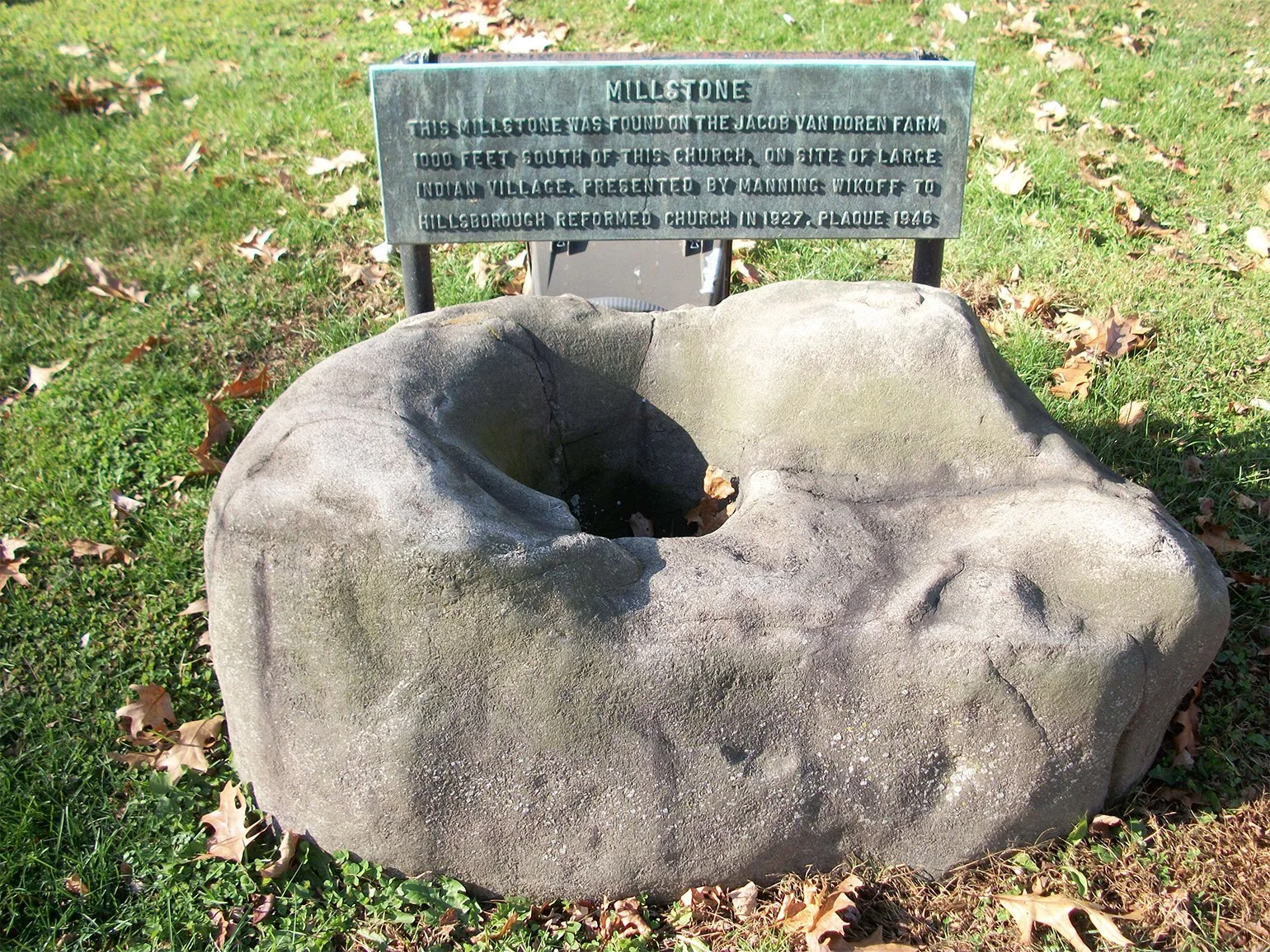
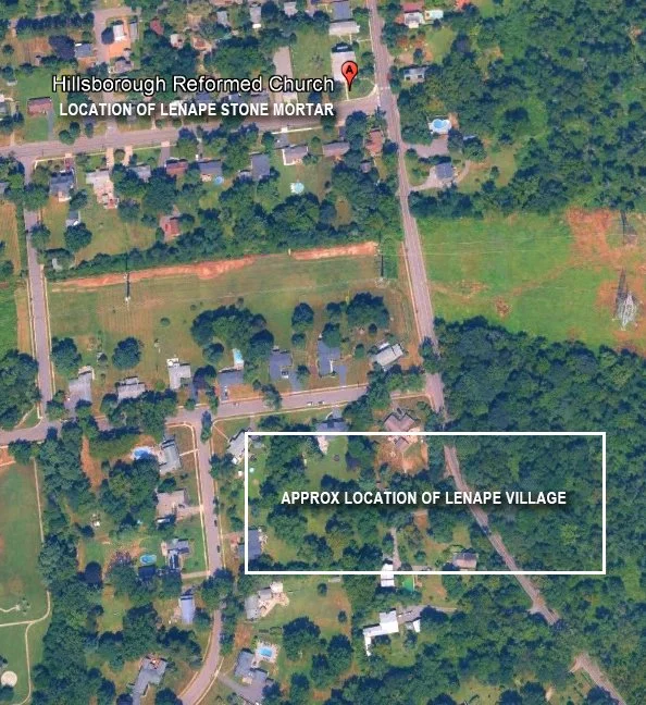
A large stone mortar, discovered on the Van Doren farm, stands outside the Hillsborough Reformed Church. Once used for processing corn, the object offers an unusually direct connection to the practical work of Indigenous life in the valley.
The borough's official master plan also records a tradition of an Indigenous village approximately 1,000 feet south of the church. The accompanying plaque identifies the location, while local historical accounts connect the area with a place described as Hunters' Wigwam. The village identification is historically significant, although its precise interpretation and the early deed tradition require caution.
Consider what the mortar represents.
It was not a ceremonial monument created to be admired centuries later. It was a working object, associated with the preparation of food and the daily responsibilities of a community. Its importance comes from its ordinariness.
The stone survived while the people who used it were displaced, the land changed ownership, and an entirely different society developed around the site.
A single object, once part of everyday life, has become a witness to centuries of change.
Millstone also occupies a meaningful position along the river that bears its name. Its fertile valley formed part of the larger Raritan region, where waterways supported agriculture, travel, and connections between Indigenous communities.
An early colonial description of the Raritan people, preserved in historical records and reproduced by the Millstone Valley Preservation Coalition, describes cultivated lowlands producing maize, beans, pumpkins, and other crops. It also portrays the valley as a place through which people traveled and traded.
Although that account reflects a European observer's perspective, it offers an important correction to the familiar image of precolonial New Jersey as an empty forest.
The Raritan Valley was already a lived-in, productive, and connected landscape.
When the Land Became Property
During the seventeenth and eighteenth centuries, the meaning of the landscape began to change under European colonization.
Land that Indigenous families had known through generations of occupation and use increasingly appeared in colonial deeds, surveys, and property transactions. Farms spread across the river terraces. Mills appeared along the streams. Roads and bridges connected growing settlements.
The changes were not simply physical.
European concepts of exclusive land ownership increasingly displaced Indigenous relationships to territory, while colonial expansion undermined Lenape communities' ability to remain on ancestral lands.
By the eighteenth century, the places that would become Somerville, Hillsborough, and Millstone were being transformed into a landscape of colonial farms and villages. Much of the earlier Indigenous presence became less visible in written histories, even as its traces remained in the ground.
Yet the archaeological evidence tells a longer story than the colonial records.
A spear point from Hillsborough speaks to human activity thousands of years before European arrival. The stone mortar in Millstone speaks to Indigenous daily life. And the Raritan River continues to connect the places where those histories unfolded.
What the Land Has Not Forgotten
The most remarkable thing about this region may be how close its ancient history remains to the present.
A person can walk through downtown Somerville, drive across Hillsborough's farmland, or visit the old church in Millstone without realizing that these familiar places contain evidence of an Indigenous past extending across thousands of years.
Some of that evidence survives in museums and archaeological records. Some remains beneath cultivated fields and modern development. And some, like the Millstone mortar, stands in plain sight.
The towns are relatively young. The human story of this valley is ancient.
And the Lenape people, whose ancestors lived throughout this region, remain living nations today. Their history is not confined to the objects left behind or the names preserved in old documents. It continues through descendants, communities, languages, and traditions far beyond the modern boundaries of Somerset County.