RaritanLenape.org > Lenape People / Stories > Lenape History, Town by Town > Ringoes & East Amwell
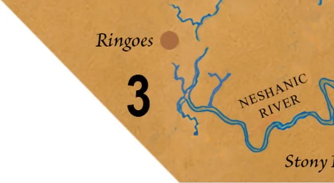
Ringoes & East Amwell
Ringoes, East Amwell, Reaville, Wertsville, Larison's Corner, Clover Hill, northeastern West Amwell.
Before the Roads, Before the Farms, Before Ringoes
Long before Ringoes became a crossroads or East Amwell's farms covered the valley, this was a living Indigenous homeland of settlements, ancient trails, and places whose names have survived for more than 300 years. From the wooded slopes of Sourland Mountain to the banks of Alexauken Creek, the landscape still holds remarkable traces of the Lenape people who knew this land centuries before Europeans arrived.
Nishalemensey: An Indigenous Settlement Recorded in 1702
One of the most intriguing discoveries in East Amwell's early history is the recorded name of an Indigenous settlement near Alexauken Creek. A colonial survey associated with Benjamin Field and Governor Andrew Hamilton refers to a place rendered in later accounts as Nishalemensey, providing a rare glimpse of a named Indigenous location before Ringoes became a colonial village.
An important historical distinction survives in the records themselves. A 1701 survey refers to a place called Wishilimensey, while a related account of a 1702 survey uses Nishalemensey. These may represent variant recordings of the same name, but their exact relationship and location remain uncertain.
The significance is considerable. The surveyors were not entering an unnamed wilderness. They were recording a landscape that already contained Indigenous settlements, established routes, and places known by names Europeans struggled to transcribe.
A related 1703 deed also mentions an Indigenous path connecting places recorded as Itshilominwing and Noshaning, further revealing the network of named locations and travel routes around the Amwell Valley.
Ringoes: Where Two Lenape Trails Met
Long before Philip Ringo established his tavern, two Indigenous travel routes converged near the crossroads that would eventually bear his name.
The Naraticong Trail, later associated with Old York Road, connected the Delaware River region with the Raritan Valley. A second route, identified in some local histories as the Malayelick Trail, ran generally north and south through the area, linking Ringoes with routes toward Trenton and the upper Delaware Valley. The historical documentation for the Malayelick name is less certain than the existence of the crossroads itself.
These trails connected Indigenous communities, hunting territories, agricultural areas, and trading destinations. They also carried families, news, and cultural traditions across Lenapehoking.
Early archaeological investigations provide additional evidence of the area's importance. A New Jersey Geological Survey report describes a possible Minisink-Neshanic-Alexauken trail corridor, connecting stoneworking sites and camps near Flemington with the Ringoes area and the Delaware River. Its proposed course was reconstructed from archaeological site locations and local traditions rather than a surviving Indigenous map.
During the 1730s, Philip Ringo acquired property and operated a tavern near the crossroads. The settlement grew around routes already established in the landscape.
Ringoes did not become a crossroads because Europeans arrived. Europeans established their crossroads settlement where Indigenous travelers had already recognized the value of the location.
The 1703 Purchase: A Homeland Divided
By the beginning of the eighteenth century, colonial proprietors were seeking control of the remaining Indigenous lands across much of western New Jersey.
In 1703, the West Jersey Council of Proprietors negotiated major land purchases involving Indigenous leaders recorded as Himhammoe and Coponnockous. Together, the transactions were associated with approximately 150,000 acres extending across portions of the Raritan and Delaware watersheds, including lands connected to the developing Amwell region.
The surviving council minutes record negotiations in June 1703 and further efforts in November to establish boundaries and secure deeds.
These transactions accelerated the division of the countryside into surveyed properties. Farms, mills, churches, and colonial roads gradually spread through the valleys, while Lenape communities faced increasing restrictions on access to their ancestral lands.
What colonial records described as purchases represented a profound transformation of the Indigenous landscape. Places that had supported generations of community life were increasingly defined by European boundaries, ownership, and settlement.
Sourland Mountain: The Land Beyond the Farms
The rocky ridge of Sourland Mountain rises above the southern edge of the Amwell Valley, forming one of the region's most distinctive natural landmarks.
Its boulder-strewn slopes, hardwood forests, springs, and streams offered a different environment from the fertile agricultural lands below. Indigenous people could draw upon these contrasting landscapes for hunting, gathering, timber, stone, and other resources.
The mountain's difficult terrain later discouraged extensive European farming on some of its slopes. Consequently, portions of the Sourlands retained wooded landscapes even as surrounding valleys were cleared and cultivated.
For Indigenous inhabitants, the mountain and valley were not separate worlds. They formed parts of a larger environment connected by streams, natural passages, and generations of knowledge about the land.
The same rocky slopes that challenged colonial farmers were part of a landscape Indigenous people had understood and used long before European settlement.
Alexauken Creek: A Name That Survived
Flowing southwest toward the Delaware River, Alexauken Creek provides one of the most tangible connections between today's geography and the region's Indigenous past.
The name is generally understood to derive from a Lenape-language place-name, although scholars have proposed different interpretations of its meaning. Among them are a Southern Unami expression associated with barren land and a possible Munsee expression referring to ants.
The creek appears in early colonial records under several spellings, reflecting European attempts to record Indigenous words. Its valley was also associated with the named settlement near Wishilimensey and an Indigenous travel route documented in 1703.
Long after the surrounding land was divided into colonial farms, the waterway retained a name rooted in the Indigenous world.
Alexauken is more than a name on a modern map. It is a surviving fragment of the language and geography of the people who knew this valley before New Jersey existed.
A Landscape That Still Remembers
Today, Ringoes is remembered for its historic crossroads, tavern, and colonial architecture. East Amwell is known for its farms, rural villages, and the wooded slopes of Sourland Mountain.
Yet these familiar places tell only the most recent chapters of a much longer history.
The recorded settlement near Nishalemensey, the Naraticong and other Indigenous trails, the 1703 land transactions, and the surviving name of Alexauken Creek reveal a landscape that was already known, traveled, and inhabited long before colonial settlement.
The Lenape people did not vanish with the arrival of European surveyors. Their descendants continue today among Lenape nations in the United States and Canada.
Before Ringoes had a name, the crossroads already existed. Before East Amwell had boundaries, the land already held communities, histories, and memories.
And beneath the roads and farms of today's Amwell Valley, that older world still leaves its mark.
< previous | explore the next town 4/12 >